
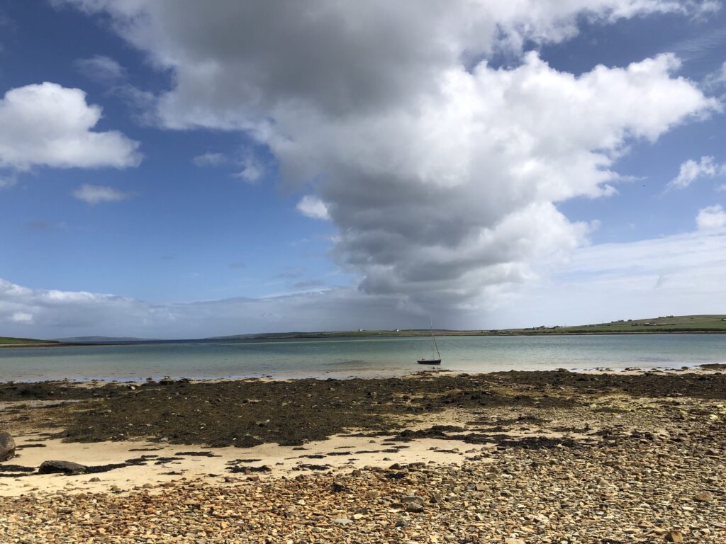
Mission Statement: Sail to the beautiful, secluded beach in the middle of Flotta (with your back to the oil storage facility)
Launch point: St Mary’s Village Public Slipway
Trail Introduction
This trail has two parts, the sail to Flotta, and then an optional extension around Flotta. The sail to Flotta is about 8 miles, and the extension is about 16 miles, so together this is about a 25 mile sail, which is best achieved when timing the route to be at the South of Flotta at Slack Low Water.
About the Area
Flotta is known for the oil terminal which takes up about a third of the island. And yet there is so much more to Flotta – the dramatic cliffs, the intimidating second world war gun batteries facing Hackness, and the beauty of the wilderness of the south side of Fara, compared with the industrial complex of the oil terminal.
There is an important note to make about the tides to the South of Flotta which could overwhelm a sailing dinghy. While Scapa Flow itself has tides of half a knot to a knot, and a tidal range of about 3 metres, the tides at the entrance to the flow are fast running and dangerous. While not troubling to a yacht, a dinghy sailor must take care as there are significant upwellings, stoppers and back-eddies which could overwhelm a small boat.
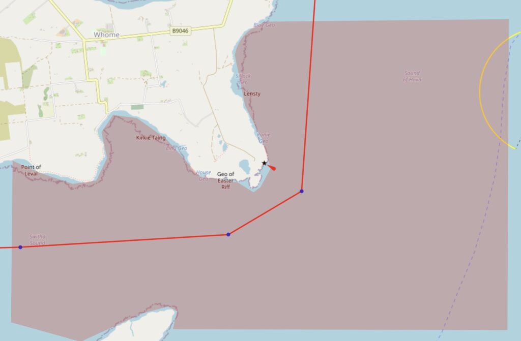
Permitted use of Openseamap under the “Creative Commons Attribution Share-Alike 2.0” license
This map is for information use only, not for navigation.
Interesting facts: The area is both spectacularly beautiful and an area of significant historical interest, almost too much to write about here.
Round Trip Distance:
16 miles or 25 miles.
Approximate Time that the Trail will take:
In a Wayfarer or similar in F4 winds, 4 to 5 hours or 7 to 8 hours
OS Map or Chart: Admiralty Chart 35: Scapa Flow and Approaches
Trail Details
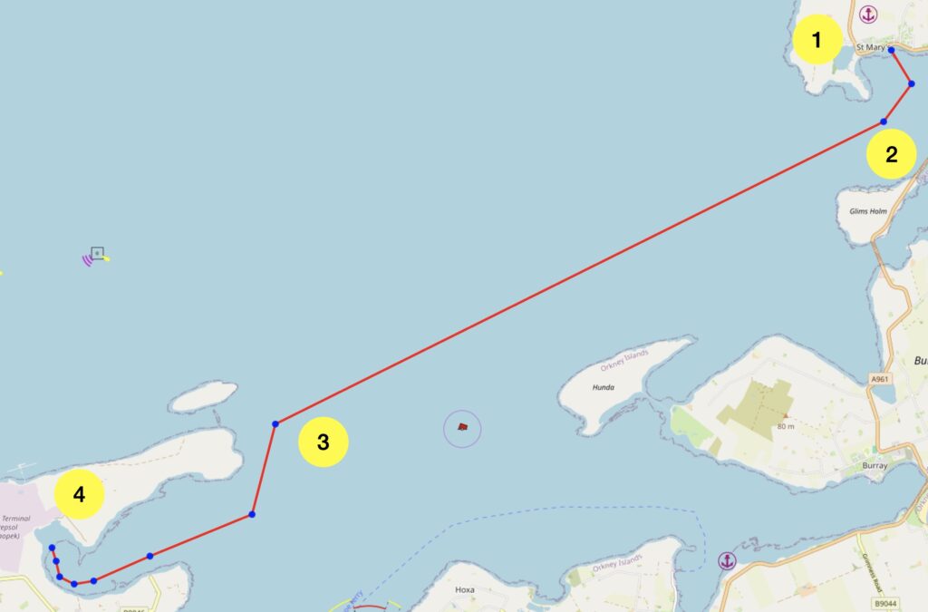
Permitted use of Openseamap under the “Creative Commons Attribution Share-Alike 2.0” license
This map is for information use only, not for navigation.
- Launch from St Mary’s Public Slipway
- Flotta should be visible from the launch point as soon as you clear the end of the pier and pass the spit of rock. Prepare for as long sail.
- There is an Isolated Danger Mark at point 3 (not marked on the OpenSeaMap) to sail North of. Reference the chart for details of the shallows between the Port mark and the IDM. Then drop South to find the wide entrance to Flotta’s harbour. See photo below.
- The harbour becomes shallower the closer to the shore that you sail, and there is a significant spit of rock to avoid on the inside of the right hand turn. Enjoy a break in a stunningly beautiful location. The return journey directly to St Mary’s follows the same route back. There are no obvious refuges on this trip.
Approaching Flotta for the first time is confusing – the entrance to the bay is not obvious.
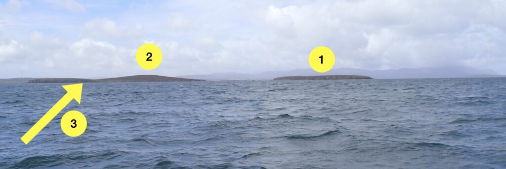
This picture is taken to the North of the Isolated Danger Mark, showing the pilotage to find the centre of Flotta.
- Calf of Flotta.
- Flotta
- The entrance to the centre of Flotta
Trip Extensions:
This is a big trip extension and requires the right tide. If you have timed your sail to Flotta with slack low water about 45m minutes after leaving Flotta’s harbour, and if the wind has been blowing a SW or W for a while, then it should be a good day to take the long route home via a clockwise circumnavigation of Flotta.
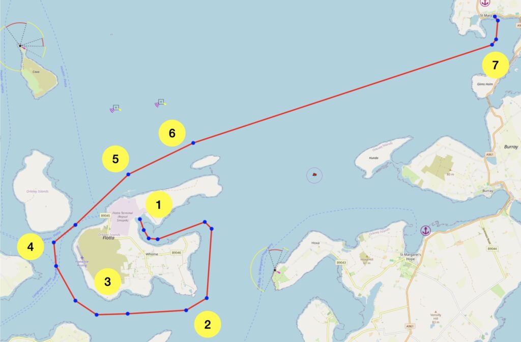
Permitted use of Openseamap under the “Creative Commons Attribution Share-Alike 2.0” license
This map is for information use only, not for navigation.
- Leave the beach at Flotta about 45 minutes before low slack water.
- Be here about slack water.
- Enjoy the menacing WW2 gun emplacements.
- And enjoy the Crockness and Hackness Martello Towers on Hoy, a good visual reference point for progress along this channel.
- As you come out of the channel between Fara and Flotta, there is a East Cardinal Mark – pass to the South and close by as this routes you away from the prohibited area around the Flotta Marine Oil Terminal jetties. At this point, the destination is about 7 miles away and hard to see, so a compass bearing would be useful – it’a about 70 degrees.
- Then, there is a further East Cardinal Mark which is to the North of the route back to St Mary’s.
- The approach to St Mary’s becomes obvious once closer.
Tidal Information
Tidal Information:
The sail to and from Flotta can be done at any state of the tide. The circumnavigation has tidal recommendations mentioned above.
Best Tides:
If you plan to lunch at Flotta and then go back to St Mary’s, any tide will do as the tidal streams are a maximum of about a knot in this area of Scapa Flow. If you plan to work the tides in your favour to sail to Flotta and return directly, best times for this dinghy trail are on a day with a low tide between 13:00 and 15:00 to give you a lunchtime stop.
If you plan to sail around Flotta, pay attention to the tidal stream information available on the Orkney Harbour website and avoid the turbulent period to the South East of Flotta 1 hour after low water.
Toilets:
There are toilets at the launch point, and no further toilets on this dinghy trail.
Further Information
Thanks to the Commodore of Holm SC for the inspiration to sail this Dinghy Trail. Holm SC Facebook Page.
Page Month Published: May 2026