
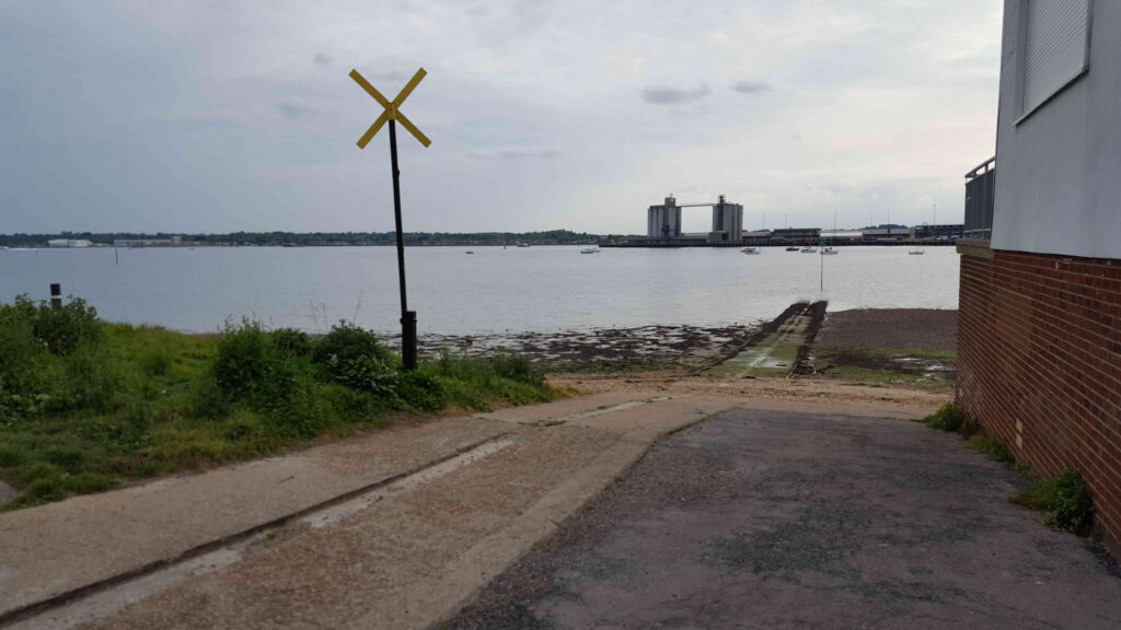
Name of the Launch Location: Southampton Sailing Club Public Slipway
Dinghy Trails from here:
Southampton SC to East Cowes
Southampton SC to Eling
About the Area: This slipway launches into Southampton Water at the confluence of the Test and Itchen Rivers.
Launch Point Lat and Long: 50.88950375491451, -1.3830656493049842
Launch Point What3Words: ///sleep.twigs.ropes
Launch Information:
This is a public slipway from which Southampton Sailing Club launch and recover.
The end of the slip way is about 1.4m above Chart Datum. On a neap tide you can launch virtually to low water with a dinghy as the slipway remains covered.
The art is getting out to the deep water, if looking at the slipway from the shore, keep to the left hand side of it and aim for the dock head. This has the greatest depth of water especially as there is an additional depth of about 30 cm right up against that side of the slipway.
During Spring tide low tide the water is easily 50m short of the end of the concrete slipway, and there’s a 30cm drop so launch and recovery is not really possible 2 hours either side of Spring Tide low water.
Remember that HW is a bit of a lottery but LW is the known constant.
Towing Vehicle Parking:
There is free parking on the roads around the sailing club. The slipway can get busy when the sailing club is running training courses.
Towing vehicle Parking What3Words: https://w3w.co/paints.wrong.factor
Towing vehicle Parking Information:
Free on-street parking around the Sailing Club and on Victoria Road.
Toilets:
The toilets at Southampton Sailing Club are not available to the general public.
Toilets What3Words: https://w3w.co/skylights.crib.conspire
Page Month Published: March 2026
Dinghy Trail Sponsor: