Mission Statement: Discover the island that gets smaller the closer you get!
Launch point: Stromness SC Public Slipway
Trail Introduction
This trail is a long sail to the middle of Scapa Flow from Stromness.
About the Area
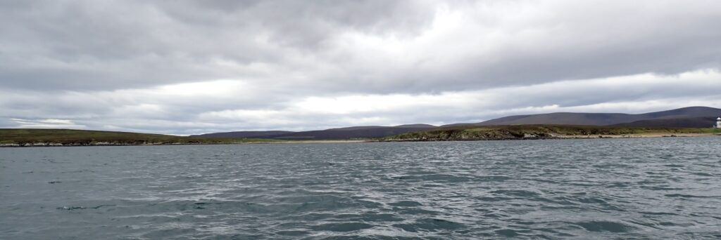
Cava is a long, small island in the middle of the Flow and, when looking at it from far away, it blends seamlessly with the islands behind it – Cava, Flotta and Fara all look like one big island. Once close enough, the shape of Cava can be identified. When approaching from Stromness, it’s quite a small island with a lighthouse on the nearest end.
Cava has two areas of beach that are suitable for landing with a dinghy – on the eastern and western ends there are shingle spits or shingle beaches, and it should be possible to find somewhere to land at all points of the wind.
Interesting fact: You’re sailing to where the German High Seas fleet was sunk, both sides of Cava.
Round Trip Distance: 15 miles
Approximate Time that the Trail will take: 4 to 6 hours depending on the wind direction, plus time to stop on Cava.
OS Map or Chart: Admiralty Chart 35 – Scapa Flow.
Trail Details
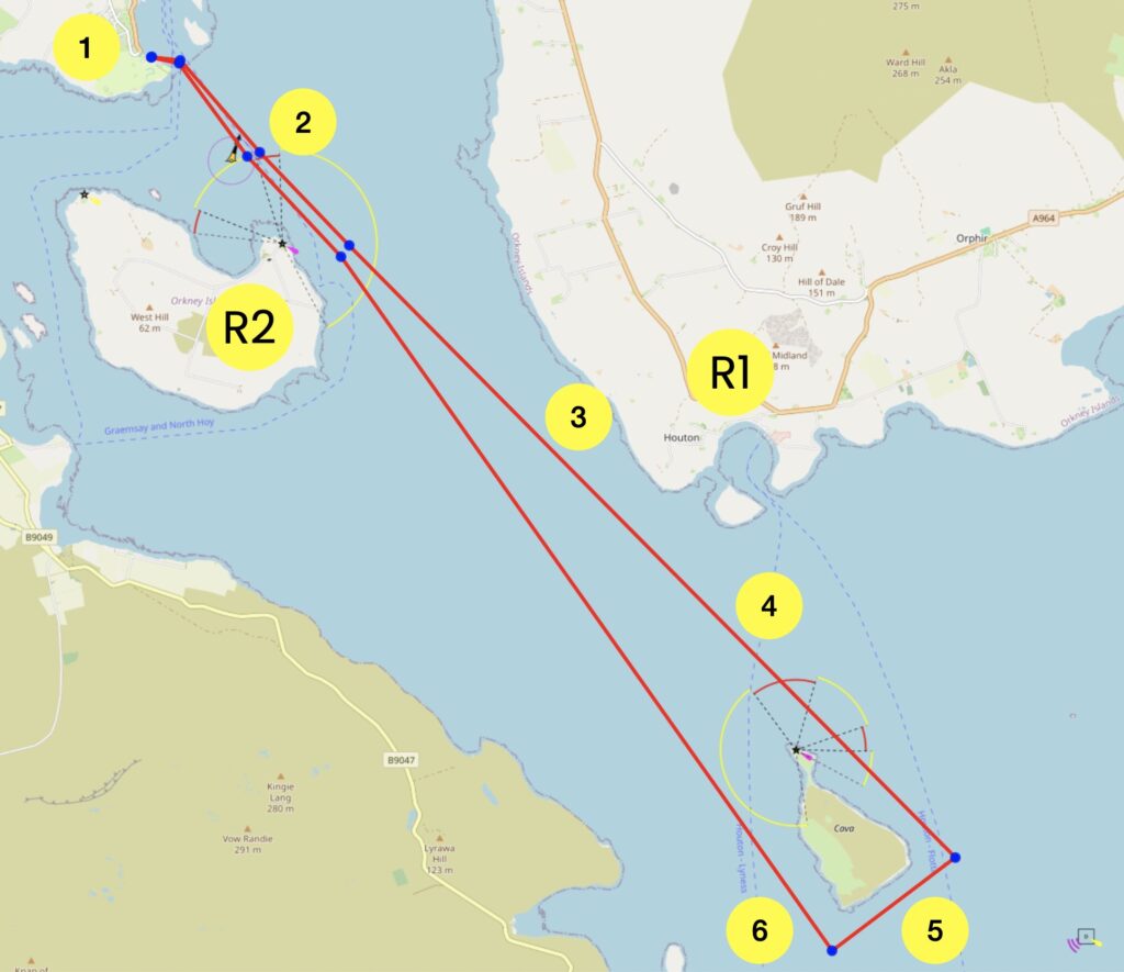
Permitted use of Openseamap under the “Creative Commons Attribution Share-Alike 2.0” license
This map is for information use only, not for navigation.
- Launch from Stromness SC Public Slipway.
- Aim towards the expanse of Scapa Flow, passing near the Cardinal Mark. There is a beach on Gramsay that could be used as a refuge.
- About here the actual shape of Cava can begin to be identified. Aim for the lighthouse for a while. Pass a refuge, the Bay at Houton.
- About here expect to see the conning tower and deck of a small submarine – but it’s just the top of the Barrel of Butter.
- There may well be a fish farm behind Cava.
- Having emerged around the back of Cava, the lighthouse on Graemsey should be one of the most visible buildings at the North-West end of the Flow. Sail back to Stromness.
Trip Extensions:
There are many options – going into Houton, or sail also around Fara depending on the wind and the appetite for a longer sail.
Tidal Information
Tidal Information:
It would be good to play the tides to advantage by being at Cava at low tide – you’ll have the tide with you there and with you back. The tide reaches about a knot so it’s easy to overcome, as long as the wind is good enough.
Best Tides:
Best times for this dinghy trail are on a day with a low tide between 13:00 and 15:00
Toilets:
There are no facilities on Cava. There is a public toilet at the ferry terminal at Houton.
Further Information
Thanks to the Commodore of Stromness SC for the inspiration to sail this dinghy trail. Stromness SC Facebook Page.
Page Month Published: May 2026