
Mission Statement: Sail from rural river, under magnificent bridges and past Devonport dock for lunch at a pub.
Launch point: Weir Quay Public Slipway
Trail Introduction
This trail starts at the Weir Quay public slipway and is a 14 mile round trip to Cremyll and the Edgcumbe Arms Public House. There are two possible landing places making it a suitable location for a windward shore landing from an Easterly (land on the West end of the Cremyll shingle) through South and West to North East where the beach makes a good windward shore landing.
The Edgcumbe Arms is a lovely pub with drinks and excellent Cornish foods, plus toilets.
This trail starts as river sailing, and then transitions to more of a rural estuary feel before passing under the road and railway bridges and then onto the military shoreline of Devonport.
The Torpoint Ferries are to be respected – they have right of way and go as soon as they are full, so watch for vehicles loading and unloading, and as soon as the traffic stops the chain ferry will go. They have right of way, so keep clear.
Occasionally there is a large ship movement – can be a cross channel ferry, and it can be a large naval ship – and the Launches will shepherd you to safe waters when this happens. Keeping a listen on channel 14 (VTS) as well as 16 gives you early warning of ship movements.
There are refuges at Cargreen, several locations along the Western side of the river under the bridges at Saltash including a public slipway and other concrete slipways, and then not much opposite the dock until the destination.
Note that there is only one refuge on the Eastern side of this cruise. The mudflats are protected for wildlife, the public slipway just under the bridges is called “Saltash Passage” and then it’s military, which much be given at least 50m of clear water and 100m for vessels. Police Launches patrol the Devonport Docks and will shoo you away if you get too close.
About the Area
Sailing in the Tamar and the waters of Plymouth are covered under a Marine Protection Authority. See https://www.plymouth-mpa.uk for information and restrictions, especially minimum distances from military vessels and sea walls.
Interesting fact: Weir Quay was part of a busy mining operation during the 1840’s until the Tamar flooded the silver mine and the venture abruptly closed. Start your search online with Weir Quay Silver Mine and enjoy a peek into the past industrial landscape.
Round Trip Distance: 14 miles
Approximate Time that the Trail will take:
Two hours in a F4 on a falling tide to get to Cremyl, an hour for lunch and 2 hours back.
OS Map or Chart:
Imray Chart C14
Trail Details
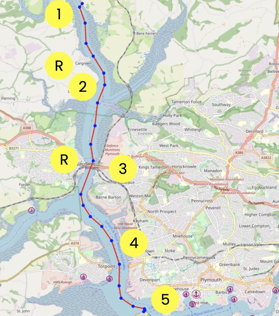
Permitted use of Openseamap under the “Creative Commons Attribution Share-Alike 2.0” license
This map is for information use only, not for navigation.
- Leave Weir Quay on an ebb tide
- Sail past Cargreen, and note and avoid the mid-channel shallows between Cargreen and the bridges
- Sail under the bridges, avoiding being uptide of the pillars. This is likely to be the most difficult sailing of this trail, as the wind either blows North or South, irrespective of the gradient wind. Note that the wind can also completely die through this section, so avoid being caught uptide of the pillars and be on the lookout for your Course Made Good. There are refuges on both sides of the river under the bridges.
- Sail past the Devonport dockyard, ensuring that you keep your distance from the vessels and infrastructure.
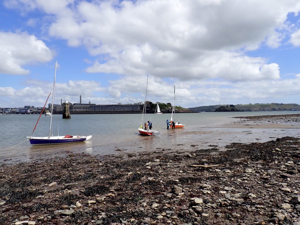
- Arrive at either the Cremyll beach (stony) or the Edgcumbe Beach (sandy at low tide, and stony, just round the corner). Avoid the huge concrete pillar that sticks out of the water just off the beach.
Refuges – Cargreen and under the bridges at Saltash on both sides.
There are two convenient beaches to land on;
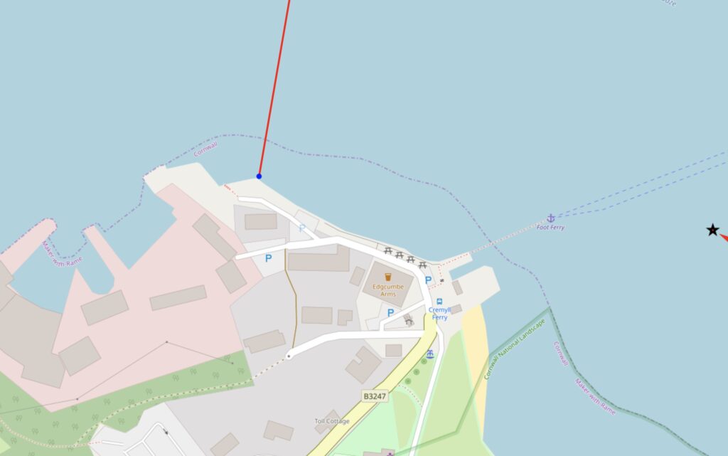
Permitted use of Openseamap under the “Creative Commons Attribution Share-Alike 2.0” license
This map is for information use only, not for navigation.
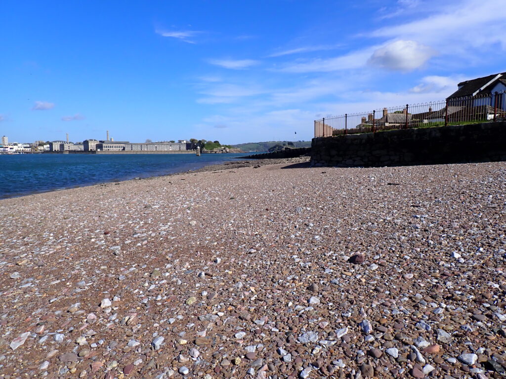
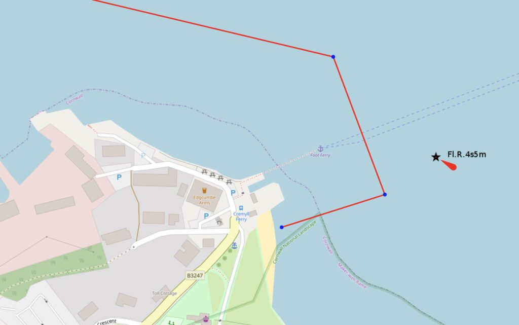
Permitted use of Openseamap under the “Creative Commons Attribution Share-Alike 2.0” license
This map is for information use only, not for navigation.
Trip Extensions:
There are many places to sail to in Plymouth Sound, as it’s just around the corner. It is recommended that you visit locations which have a windward shore on the day that you are sailing.
Tidal Information
Tidal Information:
The tide ebbs quickly, and this trail is best done to time your destination with your lunch break. Plan to sail this on a day where you launch about 2.5 hours before low water. If you want a lunchtime stop, then a low tide about 12:30 to 14:30 would be good.
Best Tides:
Best times for this dinghy trail are on a day with a low tide between 12:30 (12:30 PM) and 14:30 (14:30 PM) to have a lunchtime stop at the pub.
Toilets:
Toilets at the pub.
Further Information
Dinghy Trail Sponsor:
Name
Page Month Published: April 2026