
Dinghy Trail Under Construction
Mission Statement: An open sea passage from Fishguard to Newport and back
There are many lovely coves between Fishguard and Newport and around Dinas Head, with a chance of dolphins joining you.
About the Area: Unspoilt countryside…
Grading: We need to agree the definition, the grading will go here
Round Trip Distance: 14Nm
Approximate Time that the Trail will take in a Wayfarer or similar in F4 winds: 5 hours plus stops
OS Map or Chart: OL35 N Pembrokeshire, AC 1484 Cardigan Bay plans
Trail Details:
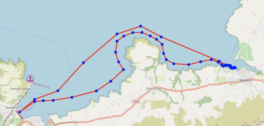
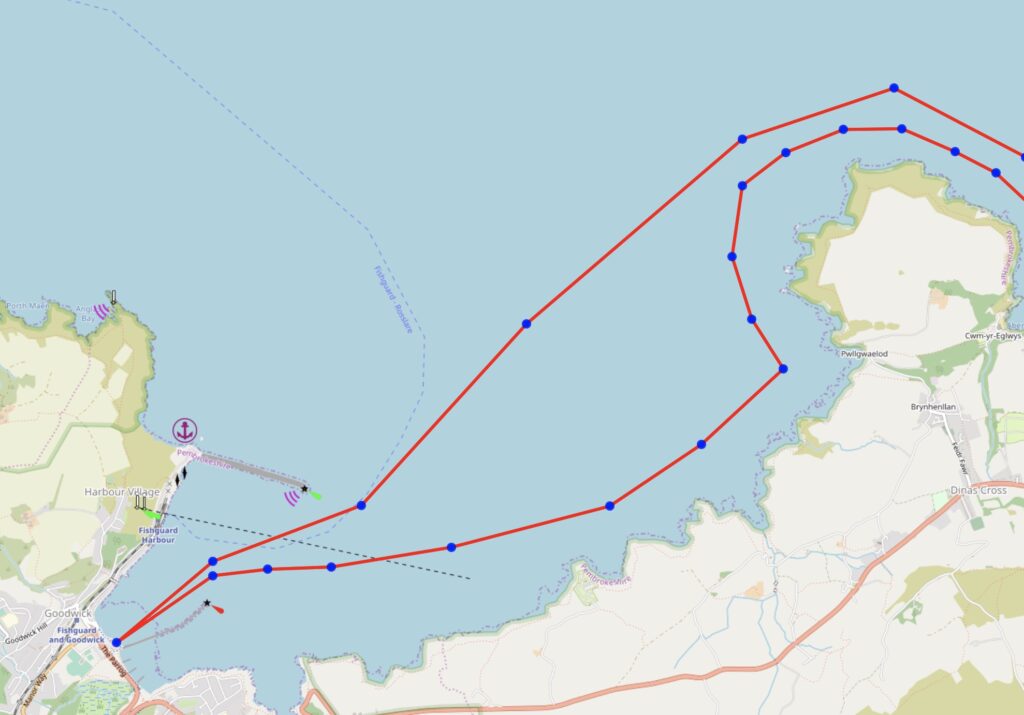
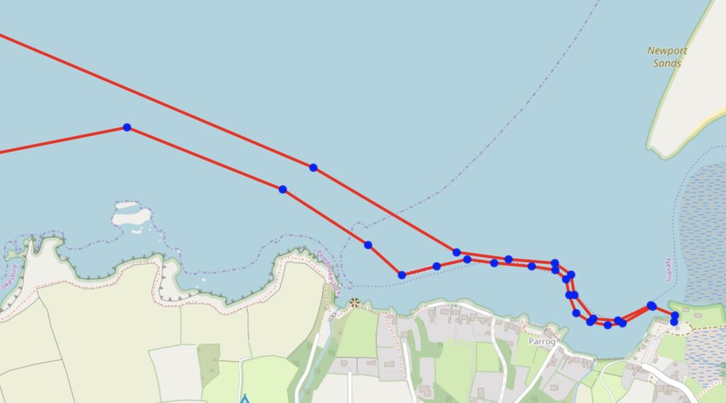
Launch at Goodwick Parrog or Fishguard Bay YC, Lower Town and head E along the coast, passing outside the Carreg Tomas outcrop just E of Castle Point. There are some interesting coves to explore on the way to Pwllgwaelod at the base of Dinas Island. Pwllgwaelod has a sandy beach and the Sailors Safety pub.
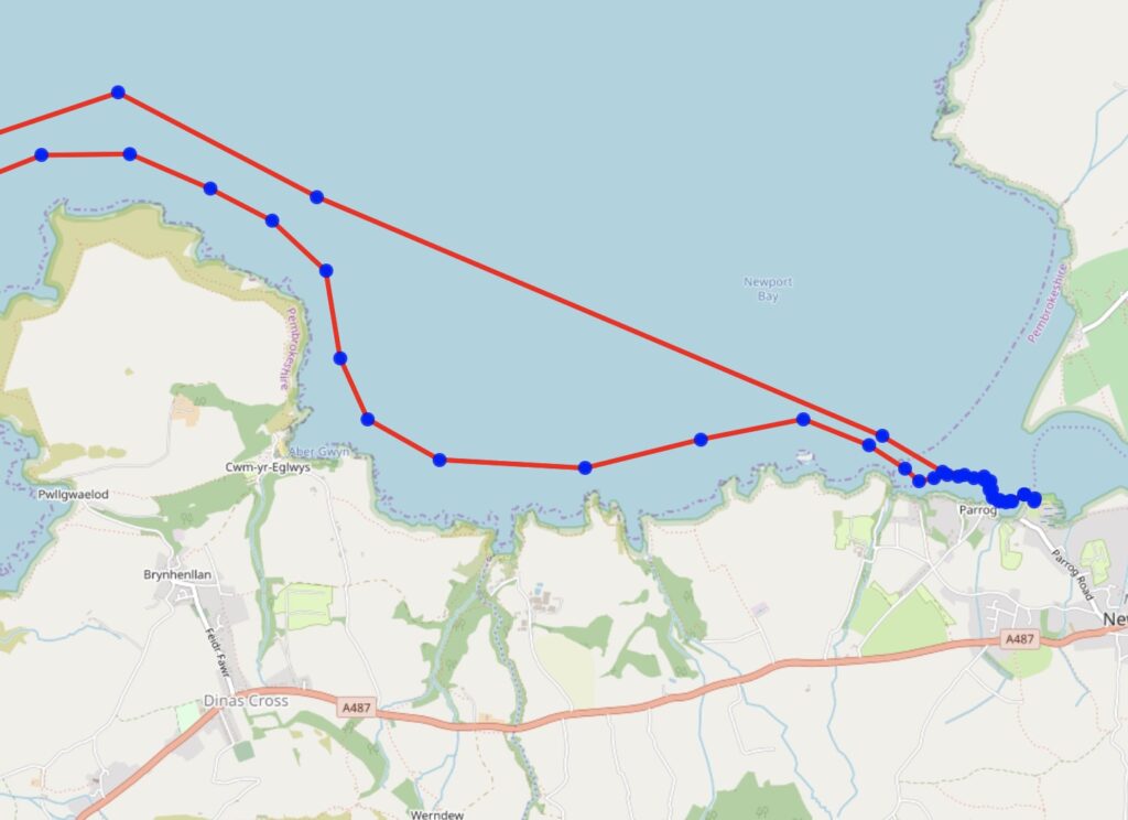
From Pwllgwaelod follow the coast around Dinas Head, watching out for wind shadows. On the east side of Dinas, pass the many birds on Needle Rock on te way into Cwm yr Eglwys, where there’s the remains of a church destroyed in the Royal Charter storm of 1859 – and an ice cream van (cash only!).
Between Cwm yr Eglwys and Newport, pass Aberfforest, a shingle beach with a waterfall 5 minutes walk up the stream and the possibility of camping.
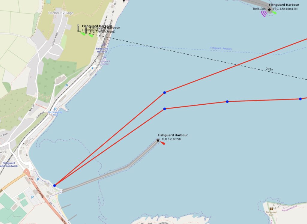
The entrance to Newport estuary is at the southern end close to Cat Rock; once inside the channel is buoyed up to Newport Boat Club (toilets, showers, bar)
Trip Extensions:
Explore the coves! And sail inside Carreg y Drywy rock on the north of Newport Bay
Launch Point Lat and Long:
Either Goodwick Parrog N 52°00.1544′ – W 4°59.4508′
or Lower Town, Fishguard N 51°59.8847′ – W 4°58.2880′
Lat and Long for integration with the RYA “Find My Nearest” service
Fishguard Bay YC N 51°59.8847′ – W 4°58.2880′
Launch Point What3Words:
Goodwick ///rocky.stadium.villager
FBYC ///notched.backpacks.hotel
Launch Information:
Public slipways, useable at all but the lowest spring tides
Costs to launch: Free
Tidal Information: The tides can reach 3 knots around Dinas Head, but are weak apart from that. Newport estuary is only accessible a couple of hours either side of HW (Milford Haven +0115). The tide flows NE from about HW -3 and SW from HW+3. So a good time to leave is around 3 hours before HW
Best Tides: Lunchtime high tide = 12,13,14,15
Towing vehicle Parking: What3Words:
Goodwick: ///creamed.hints.amending or ///acquaint.really.bravery
Lower Town: ///proposes.opposites.steers
Towing vehicle Parking Information:
At Goodwick, pay and display parking with trailer in the Parrog car park, or free over the road behind Tesco. At Lower Town, free parking in Skirmisher car park by the bridge. No overnight camping in either car park.
Trailer Parking:
The Parrog car park has bays reserved for vehicles with trailers.
Trailer Parking What3Words:
Trailer Parking Information:
Costs and things to know
Toilets:
Toilets What3Words: as car park
Toilets Information:
There are public toilets in Goodwick Parrog car park, on the quay at Lower Town. There are also toilets and showers in Fishguard Bay YC and Newport BC.
Page Month Published: March 2025
Dinghy Trail Sponsor: