
Mission Statement: Enjoy the meandering Swale and its stunning wildlife
Trail Introduction
This trail allows you to explore a sometimes overlooked dinghy cruising paradise on the Kentish coast. The Swale is a narrow channel which separates the Isle of Sheppey from the mainland and provides wonderfully sheltered waters to explore in a dinghy. Along the route there is a particularly alluring selection of waterside pubs to tempt you into dallying along the way.
About the Area:
The Isle of Sheppey is part of the Thames Estuary and has a coastline of some 40nm. The name derives from the old English Scaepig, meaning sheep. The Island has been occupied since the bronze age and has the slightly unfortunate distinction as being the site of the first documented Viking attack, which took place in 835AD. Subsequently the Isle suffered a number of further attacks from the Vikings but continued to flourish. The largest town on the island being Minster, which has some 20,000 inhabitants.
This is an area with a proud maritime history with the port of Sheerness rising to prominence after Samuel Pepys established a Royal Navy Dockyard there during the 17th century. Despite the dockyard being closed in the 1960s, Sheerness continues to flourish and is currently one of the fastest growing ports in the UK.
The Swale is a nature lover’s paradise and is both a National Nature Reserve and a Special Protection Area. This is an area rich in eel grass, knotgrass, white seakale, glassworts and golden samphire. These in turn support rare and uncommon migrant butterflies and moths, including the Essex emerald, the ground lackey and clouded yellow butterflies and the rare hawk-moths. Yet the real wonder of this area is the birds, with the low, marshy land providing ideal habitat for a number of rare species such as the Marsh Harrier, Hen Harrier and the Avocet.
Interesting Fact:
Sheppey is one of few parts of what is now the United Kingdom to be (temporarily) lost to a foreign power since William the Conqueror’s invasion in 1066. This was in June 1667, when a Dutch fleet sailing up the Thames Estuary for the Medway captured the fort at Sheerness.
Grading: We need to agree the definition, the grading will go here
Round Trip Distance: 20 miles
Approximate Time that the Trail will take: 5 hours
In a Wayfarer or similar in F4 winds
OS Map or Chart: OS 149 Admilralty 2482 & 2571
Trail Details
This map is for information use only, not for navigation.
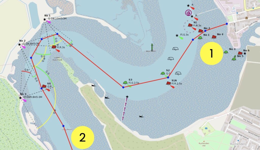
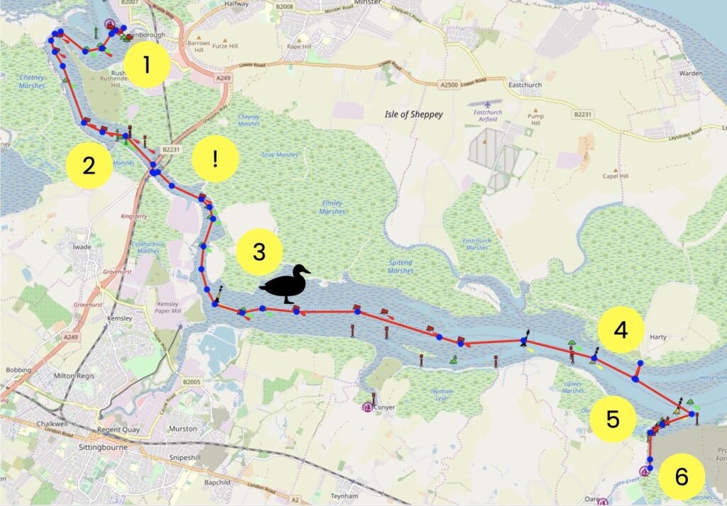
1 Start at the public slipway ideally 2-3 hours before HW and head south.
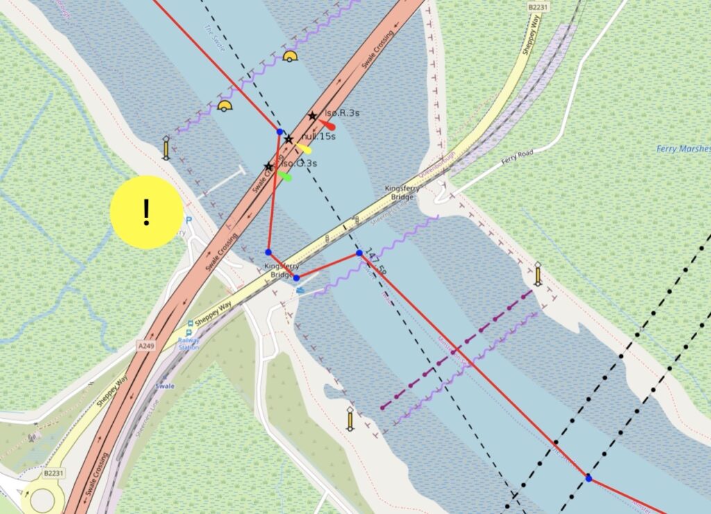
2 The river meanders a lot but the waters are sheltered and flat. You’ll pass under the A249 Sheppey Crossing road bridge (which is high enough above the water to not bother dinghies, apart from the way that it disturbs the wind) and the Kingsferry railway bridge (which is a low bridge and requires either the mast to be dropped or a capsize to get under) on the way to Harty Ferry
! Warning If navigating the Kingsferry bridge at high water you will very likely need to either lower your mast or capsize to walk the dinghy through.
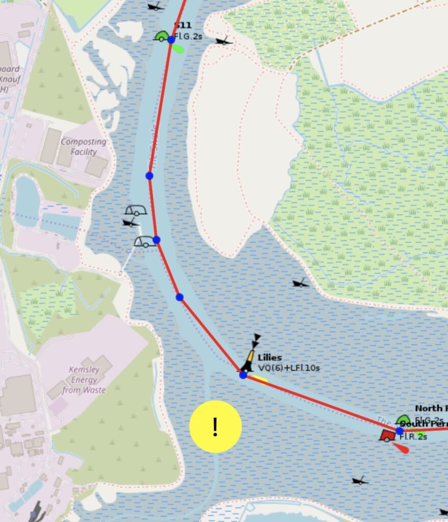
! Note that the direction of buoyage changes adjacent to Milton Creek.
3 Sail past the Elmley National Nature Reserve on your port side
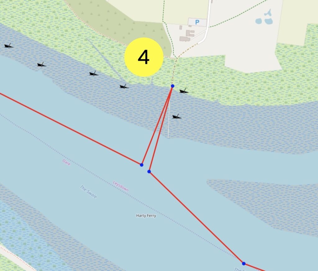
4 Get to Harty Ferry Pub. There is a public Slipway at Harty ferry and a lovely pub, the Ferry House
5 Opposite Harty Ferry there are some moorings which you can pick up for a short stay and you can have lunch there if they’re available and you don’t fancy the pub
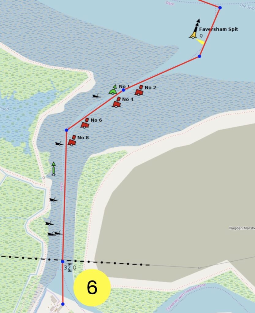
6 Head south to Faversham Creek. A short way up is another good stop off, the Shipwrights Arms. You can pull up here and enjoy a meal or a coffee
Retrace your steps to the launching point. It takes about two hours to reach Faversham Creek so by now it should be around HW. Heading back on the ebb, you’ll again punch a little foul tide before the direction of the ebb switches and takes you safely back to Queenborough
Trip Extensions:
Visit the medieval town of Sandwich visitsandwich.co.uk
Particpate in the 40 Mile Round Sheppey Race iossc.co.uk
Launch Point Lat and Long:51.41685178292572, 0.7403968422567725
Launch Point What3Words: W3W: dumplings.forkful.indeed
Launch Information: Queenborough Yacht Club public slipway
Free parking adjacent at Park Road car park ME11 5AA.
Costs to launch: Free
Tidal Information:
This trail is sheltered but has very few refuge points. You’ll be heading anticlockwise initially around the island and it’s important to work the tides to your advantage as they can be strong.
The tidal watershed switches mid way along the Isle of Sheppey so at some point you will inevitably be punching the tide. In these circumstances, work the river meanders avoiding the middle of the channel.
Imray’s East Coast Pilot is also a useful guide eastcoastpilot.com
Best Tides: The best plan is to leave a couple of hours before high water.
Towing Vehicle Parking: Free parking adjacent at Park Road car park ME11 5AA.
Towing vehicle Parking What3Words:https://w3w.co/shimmered.goad.snake
Towing vehicle Parking Information: Needs completing
Trailer Parking: Needs completing
How and where to park the trailer
Trailer Parking What3Words: Needs completing
Trailer Parking Information: Needs completing
Costs and things to know
Toilets: Needs completing
This is especially important for Inclusivity
Toilets What3Words: Needs completing
Toilets Information: Needs completing
Page Month Published: March 2025
Dinghy Trail Sponsor: