
Mission Statement: Wake up with nature in a most tranquil spot
Launch Location: Hickling Staithe
Trail Introduction:
This trail is an out and back intended to be sailed over two days. Starting from Hickling Staithe and sailing the full length of Hickling Broad and into the North East river network of the Norfolk Broads. Sail the Thurne, negotiate a swing bridge and spend the night in pure tranqulity at a beautiful little village called West Somerton.
About the Area:
Interesting fact: In the churchyard is the grave of Robert Hales, the Norfolk Giant. He was born in the village in 1820 as one of nine children. Eventually reaching 7 feet 8 inches and over 32 stone, he worked in the circus world, met Queen Victoria, and retired to a pub in London. As his health worsened he returned to Norfolk, where he died in 1863
Round Trip Distance: 10.3 m, 9 nautical miles, 16.6 Km
Approximate Time that the Trail will take: 8 hours over 2 days
OS Map or Chart: TG 46606 20128
Trail Details:
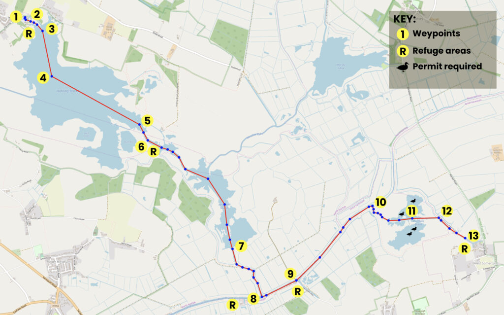
This map is for information use only, not for navigation.
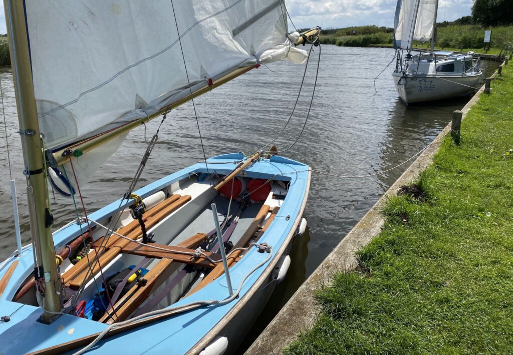
01 Start this trail at the Hickling Staithe Launch Location and follow the narrow channel.
02 There are moored boats along this narrow channel so oars or paddles or an outboard would be most useful here.
03 Carry on past the pretty thatched boat houses and out onto the broad and head in a South Easterly direction, staying within the red and green navigation marker posts. Straying outside of the channel on Hickling Broad may result in being grounded on shallow reed beds.
04 As you sail down the Broad you will sail past Catfield Dyke to starboard which was at one time a hub for the trading wherries which transported farming goods, coal and building materials around the Broads.
05 Keep within the channel markers as you exit Hickling Broad and enter the narrower channel that is Deep Go Dyke. These channels have high reeded sides and you may experience a shift in wind direction as it funnels along the channels.
06 Just inside the channel you will be able to moor alongside on the starboard side where wooden vertical sides and access steps make this an ideal spot for the perfect picnic stop. From here you can continue into the wider channel known as Heigham Sound.
07 As you exit Heigham Sound the channel will narrow again and you will enter Candle Dyke, take your time through here if you want to spot some of the amazing wildlife species that inhabit this area such as bitterns, marsh harriers and various warblers.
08 You will reach a ‘T” junction where Candle Dyke meets the River Thurne, turn left (Port) here to continue the trail. You can turn right (starboard) if you want to take a breather as Martham Boats is visible just a short way up the river on the port side. The river here is quite wide so there is plenty of room to tack if the wind is against you.
09 Martham Swing Bridge is usually in the ‘swung’ position giving priority to traffic on the water. If the bridge is closed when you arrive you will need to ask for it to be opened. There is a phone number displayed you can call or you may need to tie up to go ashore and ask.
10 Next is Devil’s Corner, a sharp right-hand bend in the river that also narrows slightly. Keep heading Eastwards, you are now coming towards the end of the first day’s sail.
11 The next narrow section will open out on both side of the river, this is MArtham Broad and you should NOT enter this broad without obtaining a permit prior to your arrival. Also be aware of the water vegetation here. Lily pads, mare’s tail, pondweeds, starworts, and stoneworts can be found in the water and can be damaged by centreboards and rudders. The area is trimmed by the local authority regularly and you may come across a floating hedge trimmer while you are there.
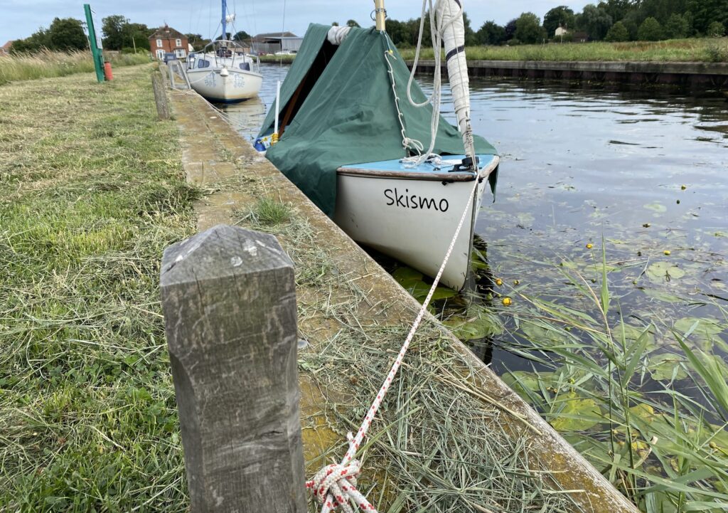
12 Another sharp bend in the river will see you entering the last leg of day one.
13 Towards the end of this channel (a dead end ) you will notice the bank on the port side is ‘piled’ and has access steps and mooring posts. With a flat grassy path too, this makes it an ideal spot for an overnight stay. There is even a water standpipe (honesty box system) if you need to top up your water supply onboard. Moor your boat, put up the boom tent and enjoy the beauty and peaceful nature of this sleepy village.
To return, just follow the above steps in reverse order.
Trip Extensions:
Within walking distance of your mooring you will have the chance to visit the ruins of the Medieval Church of St. Mary’s. Inside this church is the Witch’s Leg. The church dates back to the 15th century and can be found at OS grid reference TG 48081 19755, lat/lon 52.718345N, 1.672050E or W3W ///buying.crabmeat.neater.
There is also the Round Tower Church in the village which is where you will find the tomb of Robert Hales ( The Giant ). This church can be found at OS grid reference TG475195, lat/lon 52.71687N 1.6635999E or W3W ///arranged.perch.cope
Toilets:
There are no toilets at waypoint 13.
Page Month Published: March 2025
Dinghy Trail Sponsor: Simon Conway